Friday, March 1, 2013

Harbison State Forest


There's a first time for everything.  I've never started a day, in the dark, at Waffle House.  I've ended a day, in the dark, at Waffle House but let me move along.  I told a colleague that I would be leading a hike at Harbison State Forest and she invited me to breakfast with her geocaching group.  I said yes before I asked what time they planned to meet.  Surprise! These people voluntarily leave their beds and meet for 6:00 a.m. breakfast on a Saturday.  I joined them at 6:30 and it was a great way to start the day.  It also guaranteed my presence at the park before any of my group arrived.
Geocachers walk around in the woods...but not on a trail.  Fun group to have breakfast with.
 Hash browns, eggs, bacon, and coffee were a different kind of pre-hike breakfast for me.

Normally I ingest something protein and fruit filled and chase it with strong black coffee.
After my breakfast buddies headed out I waited a while longer and headed over to Harbison State Forest.  I planned to lead the group along the course mapped out for the Mountain in the Middle 12K.  I'd been on some of the trails but never this set linked together in this manner.  So one of my tasks before the group arrived was to make sure I understood the connections well.  I'm glad I took that time.  There was one area where the trail was completely covered by leaves and there were several branches that could lead people in the wrong direction.  I took note of that and then headed back to the meeting spot.  As soon as the group gathered, we headed off. 
Love the scarves!
We started on the Firebreak Trail, which connects all the trails in the park.  We followed that along to the Midlands Mountain Trail.  I had an oops moment, and took us off on a spur that led to an overlook of the Broad River.  My breakfast buddies happened to be there so I introduced the trail-using woods walkers to the trail-eschewing woods walkers.  We remained on Midlands Mountain until we got to Spider Woman II.  This was my favorite part of the hike.  There is one point where you come around a bend and over a slight hill to see the Broad River stretched out in front of you.
  I also loved this part of the hike because it was a little more active.  There were a few elevation changes and some rocky (well bouldery) areas to contend with.  Towards the end of this part of the trail I slowed down and let the front part of the group get ahead of me.  The back part of the group was a bit farther behind.  Spider Woman II links back up with Midlands Mountain and then I chose the Eagle Trail as the home stretch.  This was not a part of the original route but I told the group that we would detour because this trail has labelled trees. 
Sure wish I could read this photo.  Need (want) a better phone.
The Eagle Trail took us back around to our cars and there we ate a bit and waited for the remainder of the group.  According to MapMyRun/Walk/Hike/Bike/Crawl I covered the 7.31 miles in right over 2 hours.  That's actually pretty fast for a hike with pack and some hills.  I felt it the next day.  Until next time y'all.

Monday, October 22, 2012

Hikes: Seven Sisters Trail (Double Blazes are Important!)

I have several fall loves.  Two of them directly conflict with each other - hiking and college football.  If I commit to a Saturday mountain hike in the fall, I can hang it up on seeing any of my teams.  A few weeks ago the home team played so well that I was inspired to propose going to the following week's away game in Blacksburg.
 Well I was also scheduled to go on a hike with the Dames.  I miss the Dames!  But alas, the stars seemed to align for us to head to Blacksburg.  Saturday was a gorgeous day, even if the game was a bit of a downer after the first quarter.  We're still attempting to figure out how to identify a Hokie.

They did have this stuffed turkey that they called Hokie Bird...

 The next day we hiked the Seven Sisters Trail.  This trail is a part of the Big Walker Mountain Group and is in the George Washington and Jefferson National Forest.  The trailhead was about a 10 minute drive from our hotel in Wytheville, VA.  We parked one car at Stoney Creek Campground and another at the trailhead.  It is possible to walk the three miles down the road but frankly I didn't want to push our time.  Now on to the hike.  It is a 4.8 mile hike of easy to moderate difficulty...if you follow directions.
See! The sign says 4.8 miles to the campground and tells us to follow the yellow blazes.
We started the hike with me pointing out the torn up garbage bags with food all around the picnic table and the nearby large pile of dung.  I took a guess that nothing other than a black bear could do that.  I took some comfort in the regular sound of shots from hunters.  Surely bears would lay low with all of that noise.  Surely.
I was excited about having my mom out with me that day, but I believe the bear comment led her to say that I'm on my own with new experiences now.
So off we went through a lovely grove of rhododendron.  After a series of switchbacks and some mid trail clothing shedding, the trail reached a fork.  One side appeared to be more trail, but it felt like the wrong direction and there was no blaze.  The other side was a bridle (horse) trail and there was a yellow blaze in that direction.  I didn't remember reading anything about a bridle trail portion but we followed it anyway.  Down we went.  Down, down, down for about 3/4 of a mile, until we began to smell horses.  We didn't see any blazes but that was expected since the blazes had been spaced out pretty sparsely before.
Beautiful but way off our beaten path.
My friend did a little recognizance work up several paths that could be trails but saw no yellow blazes.  So we all pulled out our communication devices.  I know some of you call them phones but I have had a loaner phone for the last 5 days.  After no GPS, music, email, social media etc, I will now call my should-be-delivered-today real phone a communication device!  My friend took a look at a topographical map of the area and determined that we were off the ridge.  I took a look at another map and determined the direction of the campground and that we were not heading towards it.  My mother took a look at her phone and got frustrated by Siri.  I turned on mapmyrun and watched it as we walked Up, Up, Up to the last yellow blaze we saw.  
Wait is that a Hokie Bird feather?
 We got back up on the ridge and went to the initial fork.  My friend went up the other trail and saw no blazes.  My mom and I were standing around and then my mom spotted a blaze up a path that we did not consider.  We did not look that way because it required a full 90 degree turn from the other blaze.  We also didn't consider it because there were two more obvious choices.  Surely the park service would place a double blaze somewhere to notify us to look around for the next blaze and it would not be directly in front of us.  They did.  It was covered by a coffee can.
I would turn around and go the other way if this was wet.  It was steep and covered by leaves.  It was also not the most challenging of the hills.
 So a mile and half off the beaten path, we end up back on the correct trail.  There is nothing to say about this part of the trail other than there are several pretty major but short climbs.  Sometimes I had to put my hands down to keep from falling and the leaves made it slippery.  The views were great and I'm glad that I remembered to stop at some points and look around.


Eventually we reached the summit.  It was close to checkout time at the hotel but the great part of being at the summit is cell phone service.  I called and they were happy to extend our checkout. 
We thought surely we can cover these 2 miles, find the car in the campground, get the other car, go back to the hotel, shower, and checkout in two hours. HA!
So down we went, in the right direction this time.  As a note, we had a couple more moments on the trail where we did not see a blaze for close to a mile.  That was pretty disconcerting but we just decided to trust our technology at those points and eventually we did pass the blazes.  The trail on the way down is a bit different.  That appears to be the drainage side of the mountain.  In several places we were just walking on crushed limestone covered in moss and leaves.  
Not a lot to get a grip on.
This was actually the scariest part of the hike for several reasons.  The trail was narrow.  There was a significant drop off on one side and the wall of the hill on the other side.  Mountain bikers call this single track.  If you meet someone, there's no way for you to pass each other without someone getting off the trail.  The problem is there was nowhere to go.  I was also afraid because the surface was not easy to grip, we were going down, and my mom had on sneakers.  Luckily we made it down.  We also saw our first people of the day during this section.  Once we got to the last .6 miles, I began to run.  I wanted to get to the campground and find the car.  

When the trail put me out in the campground, a kind camper directed me to the day parking.  It was another half mile around.  A smart hiker would have driven around the campground before parking so that she could figure out the relationship between the trail head and the day parking area.  My coworker suggested that I pull out my phone whenever I park and make the car a GPS waypoint.  I'm going to use that the next time.  I got the car, went back to the trail head, picked up my mom and my friend, and then we raced back to the hotel.  We just made it.  It was a good hike but we pushed it.  I am extremely proud of my mom and feel blessed to have friends and family that support this new hobby of mine.  Until next time y'all!


Thursday, August 30, 2012

Urban Hikes: Uptown Charlotte

A few weeks ago I celebrated my birthday with a weekend trip to Charlotte.  I wanted to do something active during the weekend and thought why not do an urban hike with the friends that were coming into town.  Then my idea expanded to me planning and leading an urban hike for my hiking group.  I didn't think I would get much of a response because my hiking group is based in Charlotte.  Surely they wouldn't be interested in spending a Saturday morning walking around a place they all know.  Well I am happy that I was wrong.  I got a great response from the group. 

One of my friends and I woke up that Saturday morning with the intention to quietly put on our active clothes and go downstairs for coffee.  One friend needed to run an errand so I thought that she would sleep in a bit and then run the errand.  Well we woke her up and she ended up joining us for the hike.

She's smiling here...our first few pictures had that 'I can't believe she woke me up' look.
We hopped in the car and headed away from the hotel to The Common Market (home of really good sandwiches and salads) to meet the group.
Ready to go!
I used a guide from Charlotte's tourism board and Sparkpeople to map out a 4.7 mile trail that would take us by many of Uptown's interesting sites.  It was a good walk and a great way to see an area that most of us just drive around searching for a parking space.  I'm not going to write much more; Instead I'll tell the story in pictures.
On the way in on Tryon.
Where the Panthers beat the Dolphins the night before.
Stone city map in front of Harvey B. Gantt center.
Firebird in front of Bechtler Museum of Modern Art.  I had just the dress to match her for the evening...See below.
He is so ready for fall.


Pigs flying in a fourth ward front yard.
Unfinished church that forms a part of the McColl Center.  This site has been the home of a few fashion shows and open air art exhibits.
Mural in an uptown cupola.  You would never see this on a drive.
Judges at the 7th Street Public Market cookie contest.  Yes we got sidetracked and had to stop inside...
Nascar Hall of Fame.
AMEN!!!
That was it for the hike.  We finished off by having a great brunch at Pike's.  It was a great way to spend a morning.  Oh and about that dress that matches the Firebird...

Until next time y'all.

Thursday, August 16, 2012

Hikes: Dupont State Forest (Four Waterfalls, Katniss' Pond, and the J Crew Warehouse Sale))

Driving toward North Carolina's Dupont State Forest (near Hendersonville) I started humming "Summertime" from Gershwin's Porgy and Bess.  It was that kind of morning.  I hummed all the way to the driveway of Asbury Hills Retreat and Conference Center in Cleveland, SC.
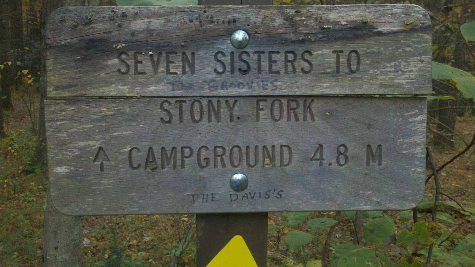
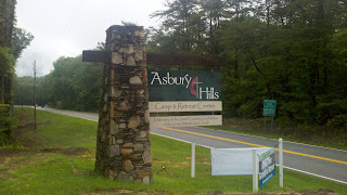
Stopped here to stretch my legs, read my directions (GPS could no longer find a signal), and take a pic.
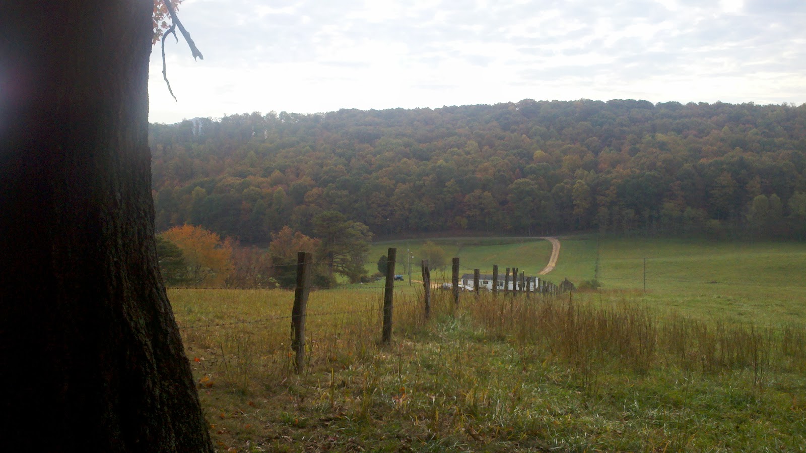
My mother had warned me that once I passed Asbury Hills heading towards Brevard the road would get a little curvy and steep (and that I'd better find an alternate route home if its going to be dark etc).  She was right.  I rolled down the window and clapped for each road biker riding up that mountain.  They are amazing.  When I arrived at the Hooker Falls trailhead, the group was pretty much ready to go.  The temperature was perfect.
I'm sure my car yelled "You Lie" to the air since it has never experienced this temperature during daylight in August.
We warmed up with a hike to and from Hooker Falls.
Insert joke about a group of women hiking to and from "Hooker Falls"
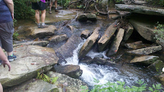
 Then we headed back through the parking lot and across the road to continue on to the remainder of the promised four waterfalls.  Our fearless leader warned that our route to Triple Falls being slightly uphill.  It was uphill, but definitely doable.
Can you count the three falls?
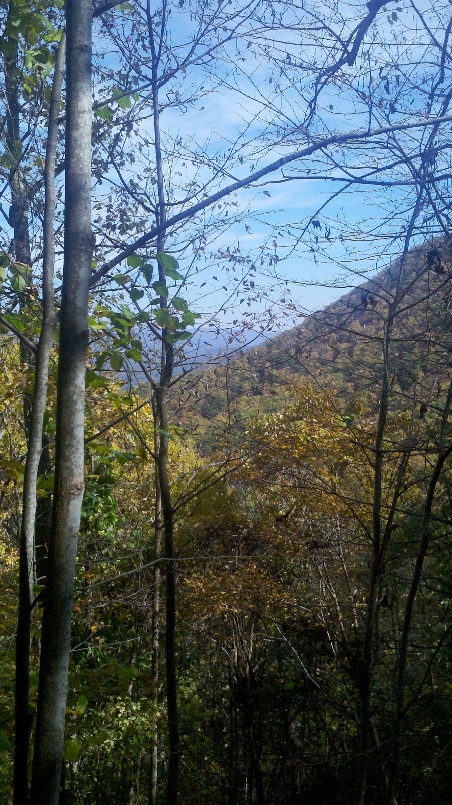
You might recognize this set of falls from a recent blockbuster movie that will remain nameless for the time being.  On past Triple Falls is a set of stairs leading down to the base of the falls.  I have nothing to report as I did not go down there.  We turned towards High Falls.  This was one of my favorite parts of our hike as it was fairly quiet.  After a short climb we reached the High Falls viewing area.
I could just post a picture of the falls but...
  Right before reaching the official viewing area, our leader pointed out the covered bridge at the top of High Falls.  That was our next point of interest...or so we thought.
Right pass our turnoff to the covered bridge we ran into a lady driving this truck.  She told us to watch out for the copperheads as she'd been seeing a lot lately and to remember to make a lot of noise WHEN we ran into a black bear.


Beautiful horses.
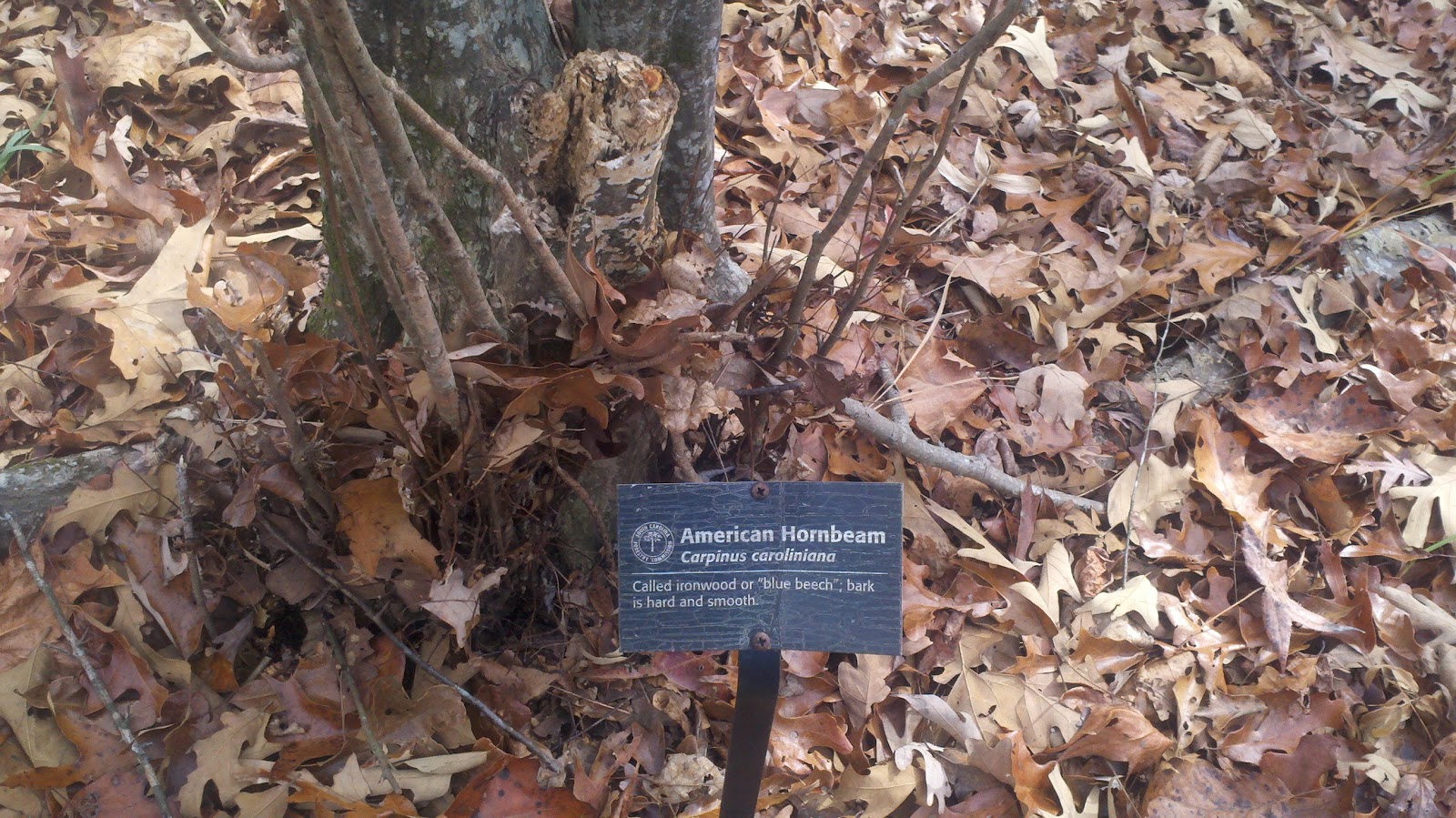
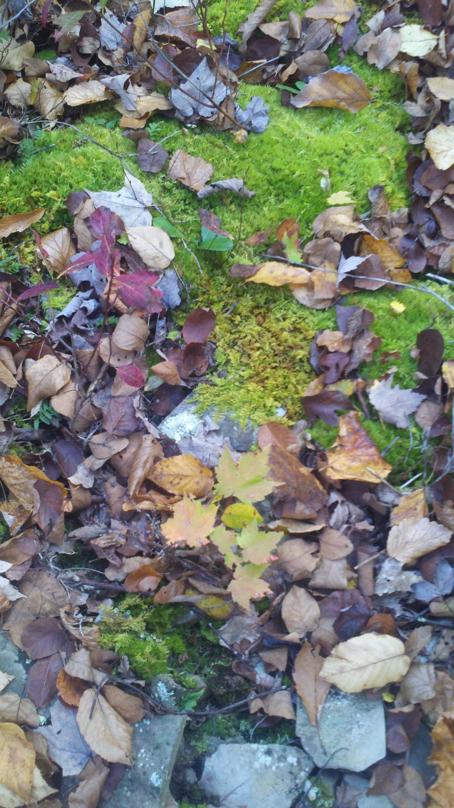
The covered bridge was a nice place to stop and take pictures.  We started to see people on horses at this point.  There are a few stables in the forest and as it was a nice day to hike, it was also a nice day to ride.  From this point on the hike was flat.  I learned how NC protects new hardwood trees.

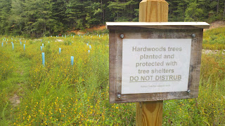
The little blue tubes protect the seedlings.
Our next goal was Bridal Veil Falls.  We planned to stop for lunch and then crawl under the falls.  I didn't know it then but I was in for a whole lot more than lunch and a pretty view.  For those that do not know (I didn't), Dupont State Forest is the site of a number of scenes from The Hunger Games.  That's great for NC's economy but I did not expect to have our fairly peaceful lunch disturbed by tourists stepping around, over, and on us to see Katniss' pond.
A hop, a skip, and a jump and we were at our lunch site viewing Bridal Veil Falls.
Tour group stepping over me.
Tour group drinking strangely colored liquid.
Tour group staff thinking "Hope these hikers/bikers/horseback riders don't tell my group that admission into the Forest is free and the N.C. tourism board has a self-guided Hunger Games tour that you can print for free."
Okay back to the hike.  We headed up Bridal Veil Falls.  No really, we headed up the falls, stepping from dry patch to dry patch on the edge.  How else would we see where a famous Last of the Mohicans scene was filmed?
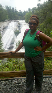
At the top of the hill, I changed to my water sandals.  Little did I know we needed to climb through brush and shimmy over a slanted bit of rock with only the assistance of a tree branch, a fellow Dame's hand, and our core.  Now I can say that yoga and pilates help me with hiking.  Here comes the reward...
Please take a picture of me. Oh no you don't need to keep my phone on this side.  I'll keep it dry...
No words! I cannot describe the sound or the feeling of being underneath these falls.
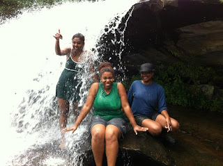
I did not start the day thinking I would sit under a waterfall but the Dame on my left (blue sweatshirt) convinced me.  I can also thank her for my need to stick my feet into cold mountain water at the end of our other hikes.  Life is good!
 After playing at Bridal Veil we started the trek back.  Since walking (falling, sliding, becoming a statistic) down the falls was not as appealing as walking up the falls, we found a "path" through the brush.  This was not a wide path and I should have changed back into my hiking shoes before getting on it.  The water sandals do not have the best grip.  We eventually retraced our steps back to the car passing what seemed like a ton of people now on the trails.  Once we made it back to the cars, I said my goodbyes.

Next stop: J. Crew Warehouse Sale!  Google navigator took me on what felt like a very circuitous 25-mile route to Arden NC's J. Crew Warehouse.  A few times a year, at two locations in North America, J. Crew clears stock at prices between 60 and 90 percent of retail.  I thought I would take a chance and see what was left since I was in the area.  After stopping at a gas station, cleaning up, and changing into my leggings/tank/dress ensemble, I went over to the warehouse and stood in line.  I waited about 30 minutes.  My coworkers that arrived before the opening were in line for 3-4 hours.  Once I entered the warehouse, I thought there is no way I am going to find anything.  It was chaos.  But then I saw the price list.  That was all the encouragement I needed.

After 2 hours of searching through boxes I landed several great work dresses, shoes, blouses, neon yellow flats, boots, a dress for one of my favorite little girls, and an all over sequin dress that I would generally never buy.  Most of my purchases were around 80 percent off and the sequin dress was more than 90 percent off.  Please note that I had no soreness from the hike, but the entire right side of my body hurt from the repeated dig and ditch motion required to make it through those boxes.

All in all it was a great day.  I was so exhausted when I finally made it back into my house at 11:30 p.m., I dozed off underneath the shower.  Until next time y'all.